The Structural Tension Between Residential Demand and Ecological Preservation
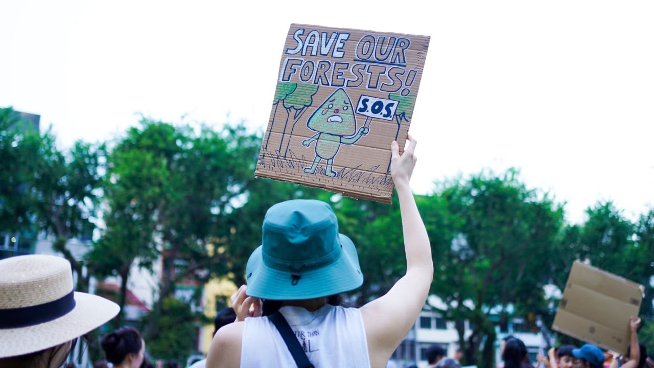
Urban planning in a land-constrained city state operates as a zero-sum equation. Every hectare allocated to residential infrastructure permanently subtracts from the municipal biosphere, while every hectare preserved places upward pressure on housing prices and density metrics. Recent public mobilizations at Hong Lim Park, organized by civil groups such as SG Climate Rally, illustrate the friction point between state-led housing expansion and ecological retention. The core dispute centers on proposed residential developments in the Maju Forest and Gillman Barracks areas, forcing a direct examination of how land-use decisions are modeled, contested, and adjusted under public scrutiny.
Understanding this conflict requires looking past surface-level political posturing to analyze the underlying resource constraints. The city-state’s land area of approximately 735 square kilometers must support both a dense urban population and vital ecological networks. When the Housing and Development Board targets secondary forests like Maju Forest or the Gillman Barracks plots, it acts on demographic projections and pent-up housing demand. Conversely, environmental advocates operate from a conservation framework that values mature secondary ecosystems not merely as aesthetic assets, but as critical biological stepping stones and carbon sinks.
The Decision Matrix of State Land Use
State land allocation follows a sequential operational pipeline designed to balance macroeconomic housing needs with environmental baseline assessments. This framework relies on specific structural inputs:
- Demographic Input Vectors: Population growth rates, household formation velocity, and public housing application backlogs dictate the baseline demand for raw land conversion.
- Environmental Impact Assessments (EIAs): Technical studies commissioned prior to rezoning evaluate flora, fauna, and hydrological connectivity to determine the ecological value of a given parcel.
- Mitigation Thresholds: Pre-determined caps on clearing percentages, such as initial proposals to retain thirty-five to forty percent of green spaces within targeted sites.
The friction arises when these institutional inputs clash with civic demands for complete preservation. For instance, initial plans for the Maju Forest site slated roughly fifteen hectares for clearance, while the Gillman Barracks area faced a similar reduction of at least ten hectares of forest cover. Government responses—such as statements from the Ministry of National Development indicating that project footprints will be recalibrated to retain higher percentages of greenery—demonstrate a reactive adjustment loop. However, this dynamic introduces planning uncertainty for both developers and citizens.
[Demographic Demand] ---> [State Land Zoning] ---> [EIA & Ecological Audit]
                                                         |
                                                         v
[Civic Mobilization] ---> [Iterative Plan Adjustment] <--- [Public Feedback Loop]
This feedback loop creates a distinct operational bottleneck. When initial plans underestimate the valuation that the public places on local micro-ecosystems, the resulting pushback forces costly redesigns, delays project timelines, and strains the social compact between urban planners and residents.
Quantifying the Opportunity Cost of Urban Forests
To evaluate whether preserving patches like Maju Forest or Gillman Barracks is economically and ecologically viable, analysts must construct a cost function that weighs urban density against ecosystem services.
The primary cost of forest retention is the displacement of housing supply. In a mature housing market, every delayed or downsized residential project in a central or accessible sector forces demand outward into less optimal locations or inflates resale and rental price indices. If authorities reduce the yield of planned homes to preserve environmental buffers, the opportunity cost is borne by young families facing extended wait times for public housing allotments.
Conversely, the cost of forest clearance involves permanent asset destruction. Unlike brownfield sites—former industrial or commercial land that can be remediated—mature secondary forests possess complex soil microbiomes, mature canopy structures, and established faunal corridors that cannot be artificially replicated within standard construction timelines. Once fragmented, the ecological connectivity between larger nature reserves degrades, leading to local extinction loops for vulnerable species.
Urban planners attempt to reconcile these competing ledgers through landscape-level mitigation, such as establishing nature parks alongside residential zones or preserving natural streams. Yet, these engineered compromises often fail to replicate the complex ecological resilience of an intact forest block.
Alternative Pathways for Spatial Optimization
Resolving the recurring gridlock between conservation and housing requires moving beyond ad-hoc public consultations toward predictive, transparent spatial modeling.
Prioritizing Brownfield Redevelopment Over Greenfield Conversion
The most effective mechanism for minimizing ecological loss is the aggressive exhaustion of brownfield reserves before touching any secondary forest. While brownfield sites often entail higher upfront remediation costs—such as soil testing, demolition, and infrastructure stripping—they carry zero net biodiversity loss. Prioritizing these parcels aligns land-use policy with long-term ecological sustainability without compromising housing targets.
Establishing Transparent Spatial Scoring Systems
Public friction frequently stems from perceived opacity in how land parcels are selected for development. Implementing a publicly accessible multi-criteria decision analysis matrix—where every potential housing site is scored transparently on biodiversity index, ecological connectivity, remediation cost, and housing yield—would anchor public debates in objective metrics rather than emotional appeals.
Dynamic Density Zoning
Where greenfield development is strictly unavoidable due to macroeconomic housing pressures, structural density should be concentrated onto a smaller footprint while leaving the remainder of the parcel untouched in perpetuity. Rather than uniform low-to-medium density dispersion across an entire forest sector, vertical optimization allows the state to achieve identical housing unit yields while preserving contiguous ecological corridors.
Future land-use planning must treat ecological networks not as residual buffer spaces to be nibbled away by incremental housing demand, but as fixed infrastructure assets whose destruction incurs measurable, long-term costs to the urban environment.