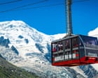
The physical reality of high-altitude alpine terrain is governed by a fragile thermodynamic balance between accumulation and ablation. When geodetic surveys of Mont Blanc reveal a measured reduction in overall elevation exceeding one meter over a twelve-month period, the immediate analytical error is to attribute the loss uniformly to glacial melting. High-altitude topography above four thousand meters operates under distinct microclimatic constraints. The total height of the summit is not merely a function of rock mass; it is dictated by the thickness of the permanent ice and snow cap that crowns the fundamental bedrock.
Understanding this dynamic requires breaking down the summit architecture into two distinct components: the stable gneiss bedrock and the variable accumulation cap. The bedrock remains structurally invariant over human timescales, while the ice cap acts as a sensitive barometer of localized wind transport, precipitation rates, and thermal energy fluxes. When precise GPS and radar interferometry campaigns record a vertical drop, they capture the net balance of mass flux rather than a simple metric of global temperature rise.
The Mass Balance Equation
The surface elevation of an ice-capped peak at any given moment is determined by the fundamental continuity equation for glacier mass balance. The total change in height over time is equal to the sum of snow accumulation from precipitation, the addition of mass via wind-driven deposition, minus the removal of mass through sublimation, surface melting, and ice avalanching.
Precipitation at elevations exceeding four thousand meters falls almost exclusively as snow. However, the retention of this snow is heavily influenced by wind shear. Ridge-line topography experiences extreme wind velocities that strip newly fallen snow from the windward slopes and redeposit it in lee zones or sweep it away from the summit entirely. Consequently, a winter with high overall precipitation does not automatically translate to a thicker summit cap if storm tracks coincide with high-velocity jet stream activity over the Alps.
Ablation mechanisms at this altitude diverge significantly from lower-altitude glacial tongues. While lower glaciers experience continuous basal and surface melt driven by positive ambient temperatures, the summit of Mont Blanc remains below freezing for the vast majority of the year. Here, surface mass loss is dominated by sublimation—the direct phase transition of ice into water vapor without an intermediate liquid phase. Sublimation is driven by solar radiation, low relative humidity, and wind speed. When incoming shortwave radiation increases due to reduced cloud cover, the energy absorbed by the white surface accelerates vapor loss, thinning the cap without generating visible meltwater runoff.
Thermal Conduction and Internal Deformation
Beneath the wind-swept surface, the internal temperature profile of the summit cap plays a critical role in its structural stability. Glaciers in the Mont Blanc massif are generally classified as cold-based or polythermal, meaning the ice is frozen to the underlying bedrock at sub-freezing temperatures. However, as atmospheric temperatures fluctuate and summer isotherms edge higher, thermal waves penetrate the upper layers of the firn and ice.
This subsurface warming reduces the viscosity of the ice. Under the relentless pull of gravity, ice on a steep summit dome experiences creep—the slow, internal deformation of ice crystals past one another. When the ice warms closer to the pressure-melting point, deformation rates increase. The summit cap effectively slumps outward and downward under its own weight, spreading laterally across the underlying rock shoulders. This mechanical redistribution of mass flattens the peak profile, reducing vertical height even if total absolute mass loss via melt or sublimation is minimal.
The Observational Artifact of Survey Timing
A rigorous analysis of decadal elevation shifts must account for methodological variables in data acquisition. Measuring Mont Blanc to centimeter-level accuracy requires deploying differential GPS receivers directly onto the highest point of the snow cap during optimal meteorological windows. Because the summit is a dynamic, wind-sculpted snowdrift rather than a stable geometric point, the exact geographic apex shifts horizontally across a plateau of several square meters from year to year.
Furthermore, the timing of the survey relative to the seasonal cycle introduces a baseline bias. A measurement taken at the end of an anomalously hot summer captures the maximum annual ablation state, whereas a survey following a heavy spring snow accumulation records a temporary inflation. Comparing these temporal snapshots without normalizing for seasonal phase offsets creates noise in the longitudinal dataset. The reported drop of over a meter represents the differential between two specific operational windows, reflecting peak-to-trough seasonal extremes compounded by multi-year meteorological trends.
Macro-Climatic Drivers and Future Topography
The localized shrinkage of the Alpine roof serves as a high-resolution indicator of shifting synoptic weather patterns across Western Europe. The primary driver of accelerated mass loss in recent decades is the increased frequency of persistent blocking high-pressure systems over the Mediterranean and Central Europe. These atmospheric blocks deflect moisture-bearing Atlantic storm tracks northward, subjecting the high Alps to extended periods of clear skies, elevated freezing levels, and intense solar radiation.
As the baseline atmospheric temperature trends upward, the threshold altitude at which summer temperatures consistently reach zero degrees Celsius migrates higher up the mountain flanks. This upward shift expands the surface area subject to positive degree-day accumulation, increasing the duration of active melting windows on the upper rock faces and snowfields.
The structural trajectory of the summit points toward a state of heightened volatility. As the permanent ice cap thins, its structural integrity diminishes, increasing the probability of localized cornice collapses and rockfall events triggered by the degradation of permafrost in the underlying jointed rock walls. Future monitoring protocols must shift from sporadic biennial surveys to continuous, autonomous remote sensing arrays that capture the high-frequency interplay between thermodynamic ablation and mechanical deformation.