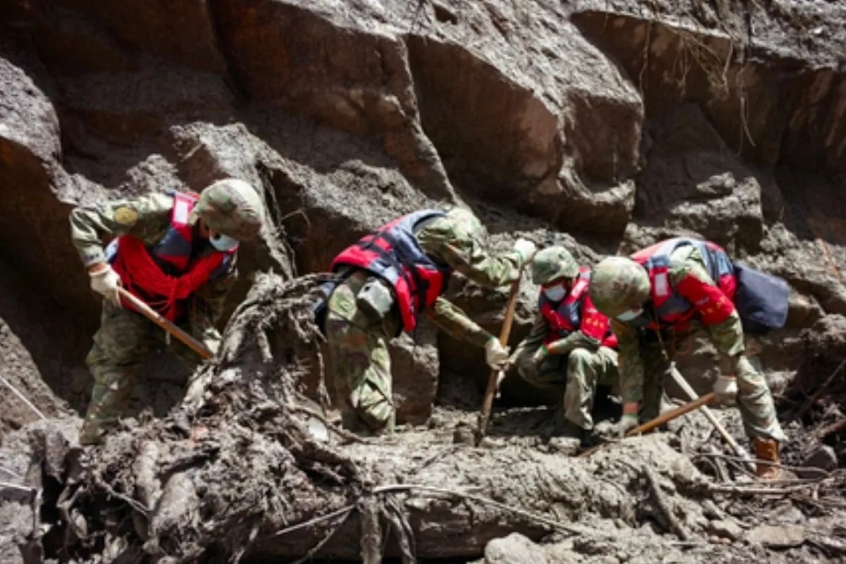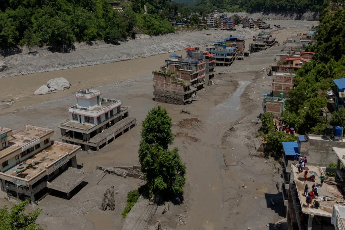
The catastrophic flash flood of August 2026 across the Nepal-China border exposed structural weaknesses in early warning infrastructure and quantified the severe threat profile of high-altitude barrier lakes. Triggered by an ice-rock avalanche and subsequent massive landslip, the initial kinetic release generated high-velocity debris flows that traversed river corridors in the trans-Himalayan region. Deconstructing this event requires analyzing the hydrological and geomorphological mechanisms that govern secondary flood waves, cross-border hazard transmission, and regional disaster response economics.
The Mechanics of Cross-Border Barrier Lake Formation
When massive volumes of rock and glacial ice collapse into narrow river gorges, the immediate consequence is a temporary natural dam. In the case of the Bhotekoshi and Trishuli river basins, debris deposition created an unstable impoundment containing millions of cubic meters of water mixed with sediment. You might also find this similar story interesting: Inside the Nepal Flash Flood Disaster That Left Hundreds Dead and Thousands Missing.
The physical hazard of such a barrier lake is a function of three primary variables:
- Inflow volume governed by upstream snowmelt, tributary discharge, and unseasonal monsoonal precipitation.
- Structural integrity of the debris matrix, which lacks engineered compaction, clay cores, or controlled spillways.
- Downstream hydraulic head pressure, which increases exponentially as water pools behind the permeable earthen wall.
Chinese hydrological monitoring stations identified that the newly formed barrier lake near the Tibet-Nepal border accumulated millions of cubic meters within a 48-hour window, leading to structural overtopping. Because these natural dams consist of unconsolidated moraine, till, and shattered rock, overtopping initiates rapid headcutting and erosion. Once piping or surface erosion breaches the threshold of the debris dam, catastrophic failure occurs within minutes, sending a hyper-concentrated mass of water and sludge downstream. As discussed in detailed coverage by Reuters, the results are widespread.
The Failure Modes of Regional Early Warning Systems
The cross-border early warning architecture managed jointly by Chinese and Nepali researchers had successfully flagged multiple glacial hazards prior to this event. However, the August 2026 disaster revealed a critical gap in detection capabilities regarding high-altitude ice-rock avalanches.
Conventional sensor deployments rely on monitoring known glacial lakes for perimeter expansion and water level anomalies. An avalanche-induced flash flood, conversely, originates from sudden mass movements of hanging glaciers or steep rock faces that may not feature pre-existing, well-defined lakes. The seismic signature generated by the initial collapse registered locally on seismometers as a 5.2 magnitude equivalent event, initially misread by automated algorithms as a tectonic earthquake rather than a mass-wasting event.
This identification lag directly compressed the response window for downstream settlements, infrastructure nodes, and hydro-engineering projects. In narrow mountainous valleys where flow velocities exceed 50 kilometers per hour, warning times measured in minutes are operationally insufficient for systematic evacuation.
Economic and Strategic Exposure of Infrastructure
The physical path of the debris torrent intersected key economic arteries, including the Gyirong Port trade hub, arterial highway bridges, and multiple active hydropower construction sites. The concentration of critical infrastructure in narrow Himalayan river corridors creates a high-consequence vulnerability profile.
Hydropower facilities are particularly susceptible due to their altitudinal placement within steep gorges. Run-of-the-river projects lack large storage reservoirs capable of absorbing sudden flood waves, resulting in the direct inundation of powerhouse structures, sedimentation of turbine intakes, and the entrapment of operational personnel.
Furthermore, the destruction of transnational transport routes disrupts bilateral trade corridors between China and South Asia. The severance of road networks isolates remote districts, forcing regional authorities to rely on emergency air corridors and international relief logistics coordinated through capital hubs like Kathmandu.
Transnational Logistics and Humanitarian Response Optimization
Disaster response in the trans-Himalayan terrain is governed by severe logistical friction. Ground access routes compromised by multiple mudslides and washed-out bridges restrict heavy machinery deployment, forcing rescue operations to depend on rotorcraft and specialized manual search teams.
Neighboring states factored into the humanitarian response through structured resource mobilization. Strategic airlift operations delivered high-altitude humanitarian and disaster relief materials, including medical supplies, water purification units, and emergency nutrition packets. Simultaneously, consular coordination mechanisms faced complex tracking demands due to the high density of foreign nationals, cross-border pilgrims, and infrastructure workforce personnel unaccounted for in remote border sectors.
Deploy synthetic aperture radar interferometry alongside continuous downstream acoustic flow monitors to track velocity anomalies in high-risk trans-Himalayan river basins before structural impoundment failures materialize.