The twin earthquakes that struck north-central Venezuela on June 24, 2026, did not just break the ground. They shattered the carefully maintained illusion of structural stability across the coastal state of La Guaira and Greater Caracas. Striking a mere 40 seconds apart at roughly 6:00 PM local time, the 7.2 and 7.5 magnitude shocks formed a rare seismic double-tap near San Felipe. The initial official statements from authorities attempted to minimize the scale of the horror, describing manageable localized damage. But orbiters passing over the Caribbean coastline forty-eight hours later captured an entirely different reality. Commercial satellite imagery has exposed a humanitarian catastrophe that conventional reporting completely missed, laying bare a staggering death toll and a systemic failure of modern infrastructure.
At least 1,430 people are confirmed dead, while more than 51,000 individuals remain officially unaccounted for as the critical 72-hour rescue window closes. For decades, geologists have warned that the proximity of the Caribbean and South American tectonic plates made the central coastline a ticking time bomb. When the fault line finally slipped, the failure was not purely natural. It was engineered by years of hyperinflation, unchecked construction, and the total abandonment of building code enforcement. For another view, consider: this related article.
The Anatomy of a Seismic Double Tap
Seismologists refer to back-to-back ruptures as a compound seismic event. The first 7.2 magnitude quake destabilized hundreds of concrete high-rise residential towers and luxury resorts across Caraballeda and Macuto. Before occupants could flee down darkened stairwells, the second, more powerful 7.5 magnitude shock wave tore through the foundations. This sequence caused an immediate vertical collapse of structural pillars, pancaking multi-story buildings into dense layers of concrete and steel. Similar reporting on the subject has been published by Al Jazeera.
Satellite views reveal that the coastal city of Caraballeda bore the absolute brunt of this structural failure. High-resolution before-and-after imagery shows that entire residential blocks along the seafront have been pulverized into uniform white dust fields. The luxury beachfront towers that once symbolized the wealth of the region were uniquely vulnerable. Their architectural designs featured soft-story ground floors, which were open spaces reserved for parking and lobbies that lacked the necessary lateral bracing to survive a sustained, multi-magnitude assault.
The physical geography of La Guaira worsened the destruction. Wedged tightly between the steep slopes of the Avila mountain range and the open sea, the narrow strip of coastal land experienced severe soil liquefaction. The water-saturated sand beneath the heavy towers behaved like a liquid during the second shock. Buildings did not merely crack or tilt. They simply slid off their foundations or sank directly into the earth, sealing the fate of thousands inside.
The Silence From Above and the Truth from Space
State television channels spent the hours following the catastrophe broadcasting outdated loops of tranquil streets and downplaying the human toll. They claimed that transport links were operational and that hospitals were handling minor injuries. This narrative collapsed when independent international analysts scrutinized radar and optical data from private satellite arrays. The orbital imagery showed that the international airports were completely paralyzed, their runways cracked and buckled by the massive shift in the underlying fault plane.
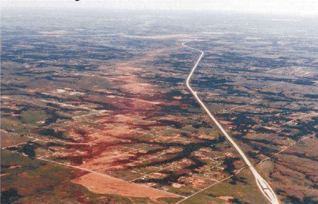
The main highway connecting the coast to Caracas was severed by massive landslides. Millions of tons of rock and topsoil slid down the mountainside, burying crucial transit arteries under fields of dirt and stone. This isolation cut off La Guaira from any immediate heavy rescue equipment. Volunteers and local emergency crews were left to dig through reinforced concrete with their bare hands, shovels, and domestic tools while hundreds of aftershocks rattled the unstable ruins.
An examination of the satellite data shows that more than 1,400 major structures were completely destroyed or compromised beyond repair. This contradicts early official assertions that damage was limited to older, informal settlements known as barrios. In reality, the destruction was democratic, destroying both the informal brick homes on the hillsides and the reinforced concrete condominiums of the middle and upper classes.
Why the Concrete Smattered
The catastrophic failure of modern concrete structures in Venezuela can be traced back to the economic realities of the past fifteen years. During the height of the construction booms, building materials were subject to severe shortages and black-market manipulation. Contractors routinely stretched their supplies of expensive Portland cement by mixing it with excessive amounts of local beach sand. Beach sand contains high levels of salt, which corrodes the internal steel rebar over time, weakening the internal skeleton of the building long before an earthquake ever occurs.
When the seismic waves hit, the internal rebar inside these columns simply snapped. The concrete crumbled instantly, losing all its load-bearing capacity.
Furthermore, independent structural audits were practically nonexistent. Bureaucratic oversight was easily bypassed through local corruption, allowing developers to add extra floors to residential buildings without strengthening the underlying foundations. The satellite images reveal exactly where these top-heavy structures existed. In several sectors of Macuto, buildings did not collapse outward; they compressed directly downward under their own illegal, unreinforced weight.
| Affected Zone | Primary Structural Vulnerability | Observed Damage via Satellite | Estimated Population Displaced |
|---|---|---|---|
| Caraballeda Seafront | Soft-story ground floors, unbraced luxury towers | Total vertical pancake collapse of seafront resorts | Greater than 25,000 |
| Macuto Commercial Strip | Unsanctioned vertical extensions, corroded rebar | Foundation sliding, severe lateral building tilt | Greater than 12,000 |
| San Felipe Epicenter | Masonry and unreinforced brick housing | Widespread flattening of low-rise neighborhoods | Greater than 15,000 |
The Logistics of a Crippled Rescue
The survival rate for individuals trapped under collapsed structures drops drastically after 72 hours. Without specialized acoustic listening devices, heavy-lift cranes, and search dogs, finding survivors in a dense debris field is an mathematical impossibility. The closing of the international airports meant that international urban search and rescue teams could not land their equipment directly where it was needed most.
Instead, early relief efforts had to rely on a slow trickle of supplies brought in via small boats or transported over hazardous mountain passes on foot. While emergency relief items from international donors reached the country within 48 hours, getting those items through the clogged, broken ports of La Guaira became a logistical nightmare.
"The true death toll will not be known for months, simply because we lack the physical capacity to move the mountain of rubble that has buried these neighborhoods," notes an international disaster response coordinator working near the border under condition of anonymity.
The satellite arrays show hundreds of makeshift camps springing up on beaches and soccer fields, entirely devoid of sanitation infrastructure. Clean water pipelines have been shattered by the displacement of the earth, forcing survivors to collect water from broken sea mains or contaminated mountain streams. This has created an environment ripe for a secondary humanitarian crisis driven by waterborne pathogens, a threat that could easily outpace the initial casualty list of the earthquake itself.
The Looming Urban Crisis
The destruction extends far beyond the immediate trauma of collapsed walls. By severing the coastal region from the capital city, the earthquake has disrupted the delicate supply chain that keeps Venezuela's central northern region functioning. Power grids remain dark across vast swathes of La Guaira, as sub-stations were crushed by falling masonry or buried under mudslides.
Rebuilding will require billions of dollars that the national treasury simply does not possess. The insurance industry in the country is virtually nonexistent after years of monetary reform and economic contraction, meaning that private property owners have no safety net to finance the clearing of rubble or the reconstruction of their homes. The tens of thousands of displaced citizens face prolonged displacement in temporary tent cities.
The satellite imagery leaves no room for debate or official obfuscation. The data recorded by these sensors stands as an unalterable record of a region completely unprepared for the forces of nature, exposed by the absolute failure of its built environment. As the last hopes of finding survivors beneath the concrete vanish, the focus must shift to how this coastline was allowed to become a mass grave, and whether any lessons will be learned before the same fault line slips again.


